geoip Search Operator
Sumo Logic can match a parsed IPv4 or IPv6 address to its geographical location on a map chart. To create the map, the geoip operator matches parsed IP addresses to their physical location based on the latitude and longitude of where the addresses originated. The precision for latitude and longitude degrees is up to five decimal places.
Any IP addresses that do not have a location, such as internal addresses, will return null values.
Syntax
geoip <ip_address_field> [<optional_field1>, <optional_field2>...]
Default result fields
- latitude
- longitude
- country_code
- country_name
- city
- state
Optional fields
Depending on how specific you’d like the output to be you can include all the optional fields or choose a subset:
- region
- continent
- postal_code
- connection_type
- country_cf
- state_cf
- city_cf
Details of these data fields can be found in Neustar's documentation under the GeoPoint Data Glossary topic.
Syntax to Map
To map the IP addresses properly you must count by the latitude and longitude fields. You must have the _count field in your results. If you want to use a different field's value rename it to _count so the map uses the field.
Your query should use the following syntax:
| parse "[ip_fieldname]" as [ip_address]
| geoip ip_address
| count by latitude, longitude, [other geo_locator fields]
This syntax produces aggregate results, so you can add a map to a Dashboard.
Limitations
- Map charts have a display limit of 10,000 results.
- Colors of map markers cannot be changed.
Examples
Sample log message:
2017-12-13 10:29:17,037 -0800 INFO [hostId=prod-frontend-1] [module=SERVICE] [logger=service.endpoint.auth.v1.impl.AuthenticationServiceDelegate [thread=btpool0-8] [remote_ip=67.180.85.25] Successful login for user 'da@users.com', organization: '0000000000000005
Using logs that match the example log format, running a query like this:
| parse "remote_ip=*]" as remote_ip
| geoip remote_ip
| count by latitude, longitude
| sort _count
would produce the following results:
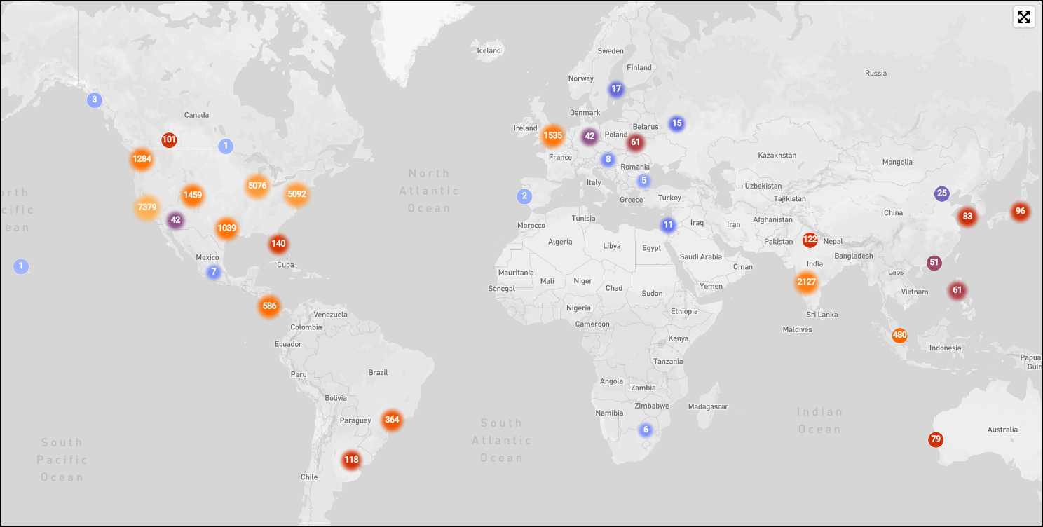
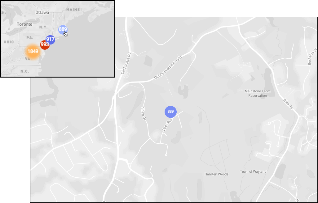
View map of geoip results
Enter a query that parses the IP field from your logs, a geoip operator to match IP addresses and return geolocation fields you’d like to use to chart each IP address.
-
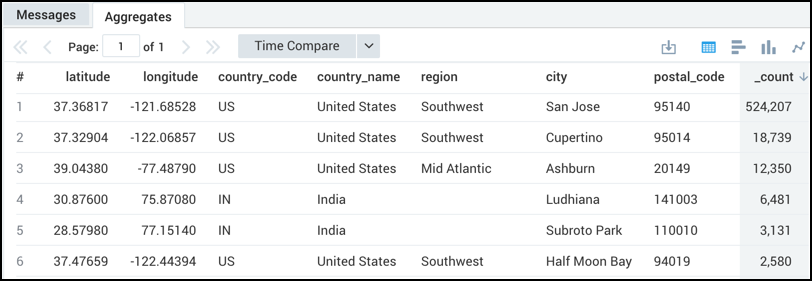
By default, results display as a table:
-
Click the Map icon in the Aggregates tab. The map displays:
-
Do any of the following:
-
Use the zoom slider to zoom in or out on an area of the map. Alternately, click and drag to zoom in or see different areas of a map.
-
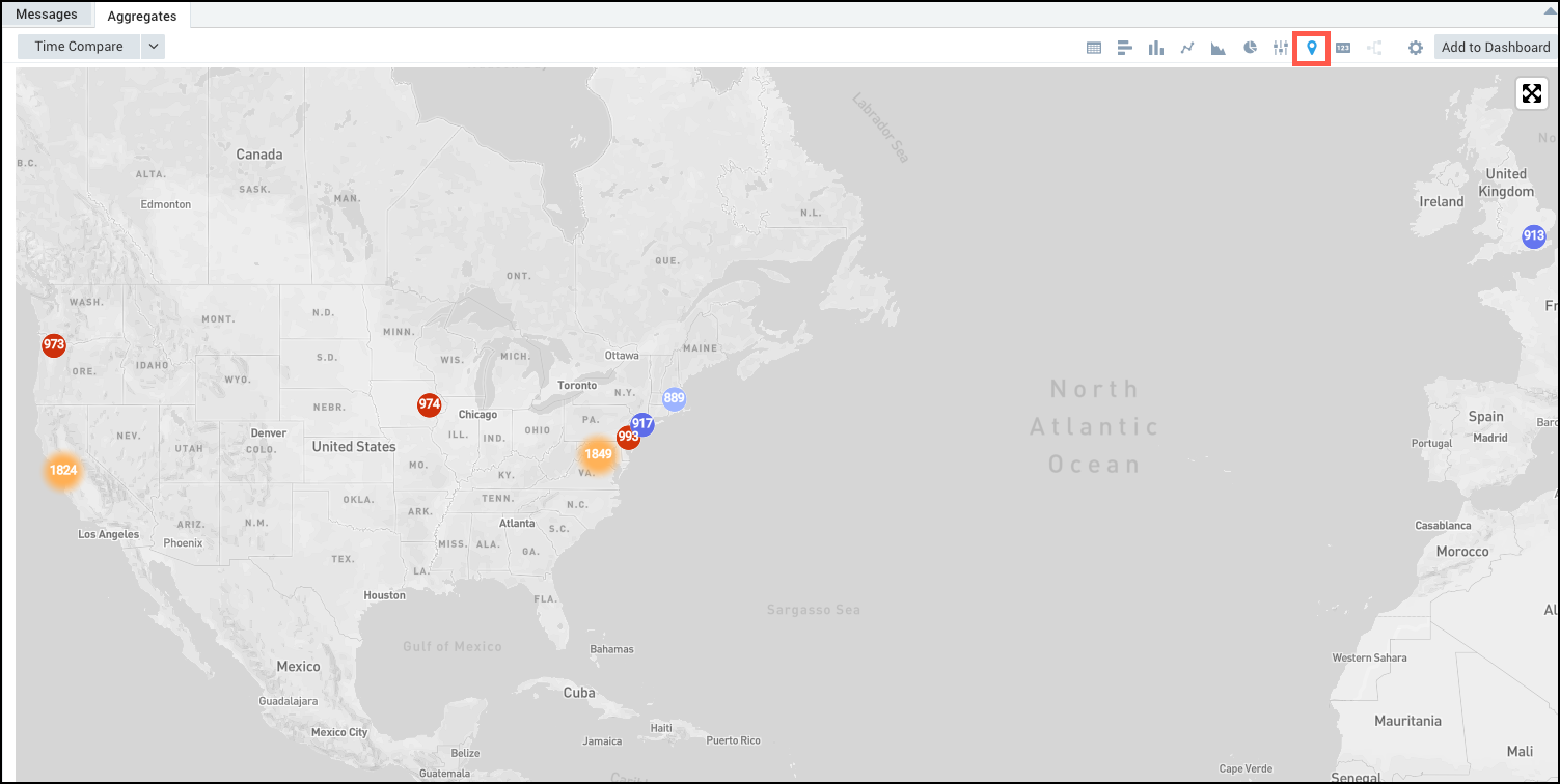
Click any marker on the map to see more detail about where IPs originate in a specific area:
-
-
(Optional) Click Add to Dashboard to create a new Dashboard or add the map to an existing Dashboard. After adding a map to a Dashboard you will still be able to zoom in and drill down on the data.
Optional fields
This example returns the optional fields region, continent, and postal_code.
| parse "remote_ip=*]" as remote_ip
| geoip remote_ip
| count by latitude, longitude, region, continent, postal_code
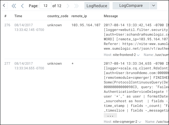
Handle null values
To find a mismatch from a geo lookup operator query, use the isNull operator.
For example, running a query like:
| parse "remote_ip=*]" as remote_ip
| geoip remote_ip
| if (isNull(country_code), "unknown", country_code) as country_code
returns results similar to: